 vesseltracker.com
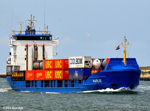
 Marus
Marus
Current Status
Where is the vessel?
Marus is currently in 16 nm NE of Cap-Haitien, based on AIS data received less than 1h ago.
Latest AIS update:
Current position: 19.96333° N, 71.99333° W (16 nm NE of Cap-Haitien)
Average speed (last 7 days): Loading…
Average speed (last 30 days): Loading…
Vessel profile: Marus is a Container Ship with dimensions 99m x 16m.
This page combines live AIS, route history, probable destination signals, nearby traffic, and port activity for practical vessel monitoring.
The current position of vessel Marus is 19.96333 lat / -71.99333 lng. Updated: 2026-05-14 21:50:09 UTCNearest reference points:
- 56 nm SW of Cockburn Harbour
- 38 nm SW of Cockburn Harbour
- 47 nm SW of Cockburn Harbour
Currently sailing under the flag of Antigua Barbuda ![]()
Marus built in 1996 year
Deadweight:
3950 tDetails:
Live Vessel Marus Analytics (details, animations, etc.)
Recent AIS points (UTC):
2026-05-14 18:00:58 UTC · 20.05167, -72.41401 · SOG 5.9 kn · COG 110°2026-05-14 19:36:08 UTC · 19.98002, -72.24943 · SOG 6 kn · COG 110°
2026-05-14 19:44:59 UTC · 19.97465, -72.23507 · SOG 5.5 kn · COG 89°
2026-05-14 21:50:09 UTC · 19.96333, -71.99333 · SOG 6 kn · COG -1°