 vesseltracker.com
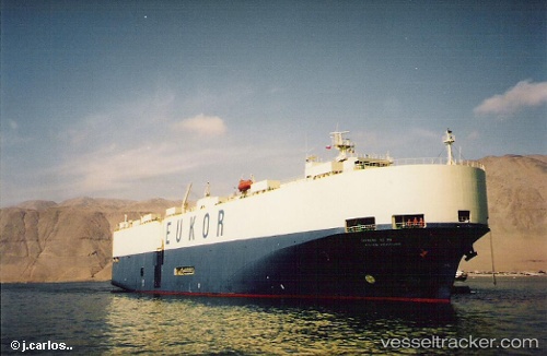
Glovis Prime
Current StatusWhere is the vessel?
Glovis Prime is currently in 136 nm SE of Porto Santo Island, based on AIS data received about 15h ago.
Latest AIS update:
Current position: 31.96973° N, 13.98893° W (136 nm SE of Porto Santo Island)
Average speed (last 7 days): Loading…
Average speed (last 30 days): Loading…
Vessel profile: Glovis Prime is a Vehicles Carrier with dimensions 31m x 184m.
This page combines live AIS, route history, probable destination signals, nearby traffic, and port activity for practical vessel monitoring.
The current position of vessel Glovis Prime is 31.96973 lat / -13.98893 lng. Updated: 2026-05-18 07:00:52 UTCNearest reference points:
- 148 nm SE of Porto Santo Island
- 109 nm E of Porto Santo Island
- 101 nm SW of Jarjis
Details:
Live Vessel Glovis Prime Analytics (details, animations, etc.)
Recent AIS points (UTC):
2026-05-18 03:54:40 UTC · 32.77620, -13.78928 · SOG 15.7 kn · COG 187°2026-05-18 04:48:44 UTC · 32.54403, -13.84678 · SOG 16 kn · COG 195°
2026-05-18 05:47:43 UTC · 32.28477, -13.91083 · SOG 15.9 kn · COG 189°
2026-05-18 07:00:52 UTC · 31.96973, -13.98893 · SOG 15.6 kn · COG 191°