Han Hui
Current StatusWhere is the vessel?
Han Hui is currently in 54 nm SE of Ben Dam Con Dao Terminals, based on AIS data received about 14h ago.
Latest AIS update:
Current position: 8.30333° N, 107.38167° E (54 nm SE of Ben Dam Con Dao Terminals)
Average speed (last 7 days): Loading…
Average speed (last 30 days): Loading…
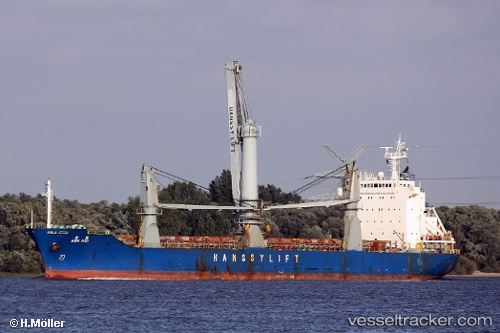
Vessel profile: Han Hui is a General Cargo Ship with dimensions 22m x 130m.
This page combines live AIS, route history, probable destination signals, nearby traffic, and port activity for practical vessel monitoring.
The current position of vessel Han Hui is 8.30333 lat / 107.38167 lng. Updated: 2026-07-26 21:46:07 UTCNearest reference points:
- 59 nm SW of Bach Ho
- 30 nm SW of Dai Hung (Tandem Load)
- 11 nm N of Gombong
Details:
Live Vessel Han Hui Analytics (details, animations, etc.)
Recent AIS points (UTC):
2026-07-26 17:40:07 UTC · 9.01500, 107.43500 · SOG 10 kn · COG -1°2026-07-26 19:37:11 UTC · 8.67666, 107.43333 · SOG 10 kn · COG -1°
2026-07-26 19:40:07 UTC · 8.66833, 107.43167 · SOG 10 kn · COG -1°
2026-07-26 21:46:07 UTC · 8.30333, 107.38167 · SOG 10 kn · COG -1°