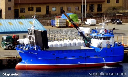
 Havilah
Current Status
Where is the vessel?
Havilah is currently in Near Belfast, based on AIS data received about 14h ago.
Latest AIS update:
Current position: 54.60963° N, 5.91455° W (Near Belfast)
Average speed (last 7 days): Loading…
Average speed (last 30 days): Loading…
Vessel profile: Havilah is a Fish Carrier with dimensions 52m x 8m.
This page combines live AIS, route history, probable destination signals, nearby traffic, and port activity for practical vessel monitoring.
The current position of vessel Havilah is 54.60963 lat / -5.91455 lng. Updated: 2026-05-22 04:27:57 UTCNearest reference points:
- Near Belfast
- Near Crossgar
- Near KILKEEL
Currently sailing under the flag of United Kingdom ![]()
Havilah built in 1999 year
Details:
Live Vessel Havilah Analytics (details, animations, etc.)
Recent AIS points (UTC):
2026-05-22 01:21:18 UTC · 54.60968, -5.91460 · SOG 0 kn · COG 43°2026-05-22 02:33:52 UTC · 54.60961, -5.91453 · SOG 0 kn · COG 43°
2026-05-22 03:59:52 UTC · 54.60959, -5.91455 · SOG 0.1 kn · COG 43°
2026-05-22 04:27:57 UTC · 54.60963, -5.91455 · SOG 0 kn · COG 43°