 FOUR PLUS
Current Status
Where is the vessel?
FOUR PLUS is currently in Near EL GUAMACHE, based on AIS data received about 15h ago.
Latest AIS update:
Current position: 10.86257° N, 64.09393° W (Near EL GUAMACHE)
Average speed (last 7 days): Loading…
Average speed (last 30 days): Loading…
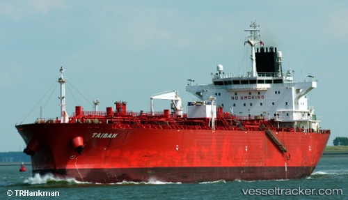
Vessel profile: FOUR PLUS is a Chemical Tanker with dimensions m x m.
This page combines live AIS, route history, probable destination signals, nearby traffic, and port activity for practical vessel monitoring.
The current position of vessel FOUR PLUS is 10.86257 lat / -64.09393 lng. Updated: 2026-07-04 15:24:27 UTCNearest reference points:
- 15 nm SW of Punta de Piedras
- Near Puerto Sucre
- Near CARENAGE
Details:
Live Vessel FOUR PLUS Analytics (details, animations, etc.)
Recent AIS points (UTC):
2026-07-04 10:57:20 UTC · 10.86262, -64.09388 · SOG 0 kn · COG -1°2026-07-04 15:24:27 UTC · 10.86257, -64.09393 · SOG 0.2 kn · COG -1°
2026-07-04 15:24:27 UTC · 10.86257, -64.09393 · SOG 0.2 kn · COG -1°
2026-07-04 15:24:27 UTC · 10.86257, -64.09393 · SOG 0.2 kn · COG -1°