 Kappagas
Current Status
Where is the vessel?
Kappagas is currently in 13 nm NW of Westende, based on AIS data received about 15h ago.
Latest AIS update:
Current position: 51.33238° N, 2.56002° E (13 nm NW of Westende)
Average speed (last 7 days): Loading…
Average speed (last 30 days): Loading…
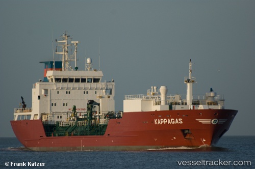
Vessel profile: Kappagas is a Lpg Tanker with dimensions 108m x 18m.
This page combines live AIS, route history, probable destination signals, nearby traffic, and port activity for practical vessel monitoring.
The current position of vessel Kappagas is 51.33238 lat / 2.56002 lng. Updated: 2026-05-20 19:04:17 UTCNearest reference points:
- 13 nm NW of Middelkerke
- Near Lombardsijde
- Near Oostende
Currently sailing under the flag of Antigua Barbuda ![]()
Kappagas built in 2001 year
Deadweight:
6211 tDetails:
Live Vessel Kappagas Analytics (details, animations, etc.)
Recent AIS points (UTC):
2026-05-20 16:25:09 UTC · 51.33222, 2.56017 · SOG 0.1 kn · COG 236°2026-05-20 16:25:10 UTC · 51.33221, 2.56017 · SOG 0.1 kn · COG 236°
2026-05-20 17:37:10 UTC · 51.33245, 2.55993 · SOG 0.1 kn · COG 235°
2026-05-20 19:04:17 UTC · 51.33238, 2.56002 · SOG 0.1 kn · COG 232°