 vesseltracker.com
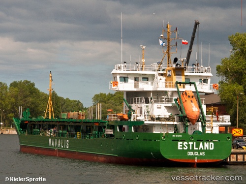
 ESTLAND
Current Status
Where is the vessel?
ESTLAND is currently in 30 nm W of Ventspils, based on AIS data received about 1h ago.
Latest AIS update:
Current position: 57.47173° N, 20.64083° E (30 nm W of Ventspils)
Average speed (last 7 days): Loading…
Average speed (last 30 days): Loading…
Vessel profile: ESTLAND is a General Cargo Ship with dimensions 99m x 17m.
This page combines live AIS, route history, probable destination signals, nearby traffic, and port activity for practical vessel monitoring.
The current position of vessel ESTLAND is 57.47173 lat / 20.64083 lng. Updated: 2026-05-16 11:55:27 UTCNearest reference points:
- Near Ventspils
- 11 nm N of Ventspils
- 18 nm N of Ventspils
Currently sailing under the flag of Portugal (MAR) ![]()
ESTLAND built in 2002 year
Deadweight:
5021 tDetails:
Live Vessel ESTLAND Analytics (details, animations, etc.)
Recent AIS points (UTC):
2026-05-16 08:11:19 UTC · 56.82030, 20.76257 · SOG 10.4 kn · COG 353°2026-05-16 09:21:20 UTC · 57.02167, 20.72333 · SOG 10 kn · COG -1°
2026-05-16 10:59:28 UTC · 57.30876, 20.65962 · SOG 10.6 kn · COG 352°
2026-05-16 11:55:27 UTC · 57.47173, 20.64083 · SOG 10.6 kn · COG 347°