 PAPUA
PAPUA
Current Status
Where is the vessel?
PAPUA is currently in Near ARKHANGELSK, based on AIS data received about 15h ago.
Latest AIS update:
Current position: 64.58199° N, 40.69901° E (Near ARKHANGELSK)
Average speed (last 7 days): Loading…
Average speed (last 30 days): Loading…
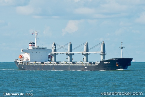
Vessel profile: PAPUA is a Bulk Carrier with dimensions m x m.
This page combines live AIS, route history, probable destination signals, nearby traffic, and port activity for practical vessel monitoring.
The current position of vessel PAPUA is 64.58199 lat / 40.69901 lng. Updated: 2026-05-21 04:04:06 UTCNearest reference points:
- Near ARKHANGELSK
- Near Novodvinsk
- Near Ekonomiya
Currently sailing under the flag of Liberia ![]()
Details:
Live Vessel PAPUA Analytics (details, animations, etc.)
Recent AIS points (UTC):
2026-05-21 01:22:00 UTC · 64.59124, 40.71972 · SOG 3.3 kn · COG 311°2026-05-21 01:39:17 UTC · 64.59608, 40.70747 · SOG 3.5 kn · COG 311°
2026-05-21 03:44:57 UTC · 64.57807, 40.72260 · SOG 6.5 kn · COG 311°
2026-05-21 04:04:06 UTC · 64.58199, 40.69901 · SOG 7.3 kn · COG 311°