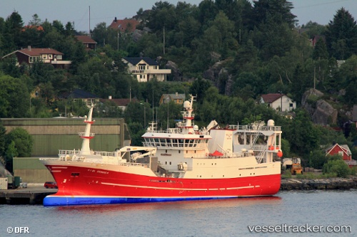
 Brennholm
Current Status
Where is the vessel?
Brennholm is currently in Near Rubbestadneset, based on AIS data received about 14h ago.
Latest AIS update:
Current position: 59.82077° N, 5.26338° E (Near Rubbestadneset)
Average speed (last 7 days): Loading…
Average speed (last 30 days): Loading…
Vessel profile: Brennholm is a Fish Carrier with dimensions 75m x 16m.
This page combines live AIS, route history, probable destination signals, nearby traffic, and port activity for practical vessel monitoring.
The current position of vessel Brennholm is 59.82077 lat / 5.26338 lng. Updated: 2026-06-28 13:31:41 UTCNearest reference points:
- Near SANDVIKVAAG
- Near TORANGSVAG
- Near Valevåg
Currently sailing under the flag of Norway ![]()
Brennholm built in 2007 year
Details:
Live Vessel Brennholm Analytics (details, animations, etc.)
Recent AIS points (UTC):
2026-06-28 10:28:41 UTC · 59.82075, 5.26341 · SOG 0 kn · COG 242°2026-06-28 11:58:39 UTC · 59.82075, 5.26339 · SOG 0 kn · COG 243°
2026-06-28 13:28:45 UTC · 59.82076, 5.26337 · SOG 0 kn · COG 243°
2026-06-28 13:31:41 UTC · 59.82077, 5.26338 · SOG 0 kn · COG 243°