 vesseltracker.com
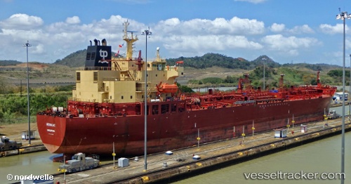
 STARWAY
Current Status
Where is the vessel?
STARWAY is currently in 18 nm NW of Al Jeer Port, based on AIS data received about 23h ago.
Latest AIS update:
Current position: 26.29482° N, 55.86854° E (18 nm NW of Al Jeer Port)
Average speed (last 7 days): Loading…
Average speed (last 30 days): Loading…
Vessel profile: STARWAY is a Oil/Chemical Tanker with dimensions m x m.
This page combines live AIS, route history, probable destination signals, nearby traffic, and port activity for practical vessel monitoring.
The current position of vessel STARWAY is 26.29482 lat / 55.86854 lng. Updated: 2026-05-17 11:08:50 UTCNearest reference points:
- 20 nm NW of Hulaylah Terminal
- Near Hulaylah Terminal
- 13 nm NW of Hulaylah Terminal
Currently sailing under the flag of Panama ![]()
Details:
Live Vessel STARWAY Analytics (details, animations, etc.)
Recent AIS points (UTC):
2026-05-17 11:08:50 UTC · 26.29482, 55.86854 · SOG 3.2 kn · COG 47°2026-05-17 11:08:50 UTC · 26.29482, 55.86854 · SOG 3.2 kn · COG 47°
2026-05-17 11:08:50 UTC · 26.29482, 55.86854 · SOG 3.2 kn · COG 47°
2026-05-17 11:08:50 UTC · 26.29482, 55.86854 · SOG 3.2 kn · COG 47°