 VICTORIA CLIPPER V
Current Status
Where is the vessel?
VICTORIA CLIPPER V is currently in Near Port Townsend, based on AIS data received about 14h ago.
Latest AIS update:
Current position: 48.19920° N, 122.80995° W (Near Port Townsend)
Average speed (last 7 days): Loading…
Average speed (last 30 days): Loading…
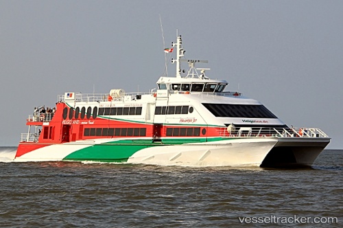
Vessel profile: VICTORIA CLIPPER V is a High speed craft with dimensions m x m.
This page combines live AIS, route history, probable destination signals, nearby traffic, and port activity for practical vessel monitoring.
The current position of vessel VICTORIA CLIPPER V is 48.19920 lat / -122.80995 lng. Updated: 2026-07-01 16:34:49 UTCNearest reference points:
- Near Anacortes
- Near FRIDAY HARBOR
- Near ORCAS
Currently sailing under the flag of Bahamas ![]()
Details:
Live Vessel VICTORIA CLIPPER V Analytics (details, animations, etc.)
Recent AIS points (UTC):
2026-07-01 13:19:55 UTC · 47.58790, -122.35331 · SOG 0 kn · COG 181°2026-07-01 13:47:43 UTC · 47.61346, -122.35362 · SOG 0 kn · COG 86°
2026-07-01 16:17:19 UTC · 48.10716, -122.64759 · SOG 28.5 kn · COG 329°
2026-07-01 16:34:49 UTC · 48.19920, -122.80995 · SOG 29.3 kn · COG 297°