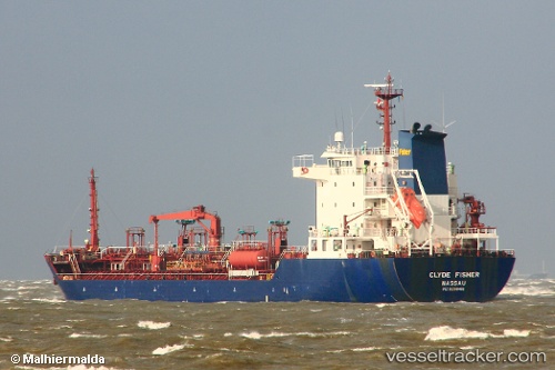
 CLYDE
CLYDE
Current Status
Where is the vessel?
CLYDE is currently in 15 nm SW of IKA JZ, based on AIS data received about 14h ago.
Latest AIS update:
Current position: 44.12448° N, 13.31248° E (15 nm SW of IKA JZ)
Average speed (last 7 days): Loading…
Average speed (last 30 days): Loading…
Vessel profile: CLYDE is a Oil/Chemical Tanker with dimensions m x m.
This page combines live AIS, route history, probable destination signals, nearby traffic, and port activity for practical vessel monitoring.
The current position of vessel CLYDE is 44.12448 lat / 13.31248 lng. Updated: 2026-05-22 11:39:58 UTCNearest reference points:
- Near Fano
- Near Gabicce Mare
- Near IVANA C
Currently sailing under the flag of Barbados ![]()
Details:
Live Vessel CLYDE Analytics (details, animations, etc.)
Recent AIS points (UTC):
2026-05-22 08:14:36 UTC · 44.42300, 12.59055 · SOG 11.9 kn · COG 78°2026-05-22 09:25:47 UTC · 44.39207, 12.89923 · SOG 11.2 kn · COG 110°
2026-05-22 10:03:27 UTC · 44.35137, 13.05659 · SOG 11.2 kn · COG 110°
2026-05-22 11:39:58 UTC · 44.12448, 13.31248 · SOG 11.4 kn · COG 124°