 vesseltracker.com
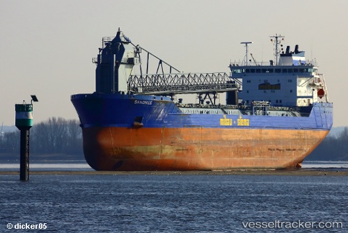
 Sandnes
Current Status
Where is the vessel?
Sandnes is currently in Near Stader Sand, based on AIS data received less than 1h ago.
Latest AIS update:
Current position: 53.65383° N, 9.50967° E (Near Stader Sand)
Average speed (last 7 days): Loading…
Average speed (last 30 days): Loading…
Vessel profile: Sandnes is a Self Discharging Bulk Carrier with dimensions 166m x 24m.
This page combines live AIS, route history, probable destination signals, nearby traffic, and port activity for practical vessel monitoring.
The current position of vessel Sandnes is 53.65383 lat / 9.50967 lng. Updated: 2026-05-15 03:56:50 UTCNearest reference points:
- Near Stader Sand
- Near Abbenfleth
- Near STADE
Currently sailing under the flag of Antigua Barbuda ![]()
Sandnes built in 2005 year
Deadweight:
27711 tDetails:
Live Vessel Sandnes Analytics (details, animations, etc.)
Recent AIS points (UTC):
2026-05-14 22:37:22 UTC · 53.87855, 9.12326 · SOG 9.3 kn · COG 82°2026-05-14 23:58:51 UTC · 53.72717, 9.45450 · SOG 11.9 kn · COG 131°
2026-05-15 01:15:51 UTC · 53.65517, 9.50917 · SOG 1.2 kn · COG 347°
2026-05-15 03:56:50 UTC · 53.65383, 9.50967 · SOG 0 kn · COG 344°