 HARMONY N
Current Status
Where is the vessel?
HARMONY N is currently in 81 nm SE of Port Saint John's, based on AIS data received about 14h ago.
Latest AIS update:
Current position: 32.84777° S, 30.22888° E (81 nm SE of Port Saint John's)
Average speed (last 7 days): Loading…
Average speed (last 30 days): Loading…
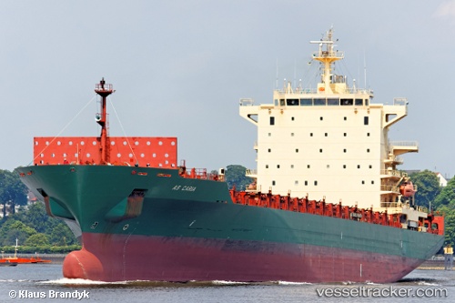
Vessel profile: HARMONY N is a Container Ship with dimensions m x m.
This page combines live AIS, route history, probable destination signals, nearby traffic, and port activity for practical vessel monitoring.
The current position of vessel HARMONY N is -32.84777 lat / 30.22888 lng. Updated: 2026-07-16 08:13:37 UTCNearest reference points:
- 23 nm E of Port Saint John's
- 125 nm SE of Port Edward
Details:
Live Vessel HARMONY N Analytics (details, animations, etc.)
Recent AIS points (UTC):
2026-07-16 04:23:05 UTC · -33.05668, 29.60685 · SOG 7.8 kn · COG 57°2026-07-16 05:27:17 UTC · -33.00355, 29.76958 · SOG 8.5 kn · COG 68°
2026-07-16 07:57:59 UTC · -32.86265, 30.18765 · SOG 9 kn · COG 68°
2026-07-16 08:13:37 UTC · -32.84777, 30.22888 · SOG 8.6 kn · COG 67°