 vesseltracker.com
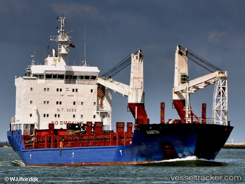
Holandia
Current StatusWhere is the vessel?
Holandia is currently in Near Hulhulé Island, based on AIS data received about 15h ago.
Latest AIS update:
Current position: 4.18683° N, 73.49894° E (Near Hulhulé Island)
Average speed (last 7 days): Loading…
Average speed (last 30 days): Loading…
Vessel profile: Holandia is a Multi Purpose Carrier with dimensions 21m x 138m.
This page combines live AIS, route history, probable destination signals, nearby traffic, and port activity for practical vessel monitoring.
The current position of vessel Holandia is 4.18683 lat / 73.49894 lng. Updated: 2026-05-18 04:13:22 UTCNearest reference points:
- Near Maamigili Port
Details:
Live Vessel Holandia Analytics (details, animations, etc.)
Recent AIS points (UTC):
2026-05-18 01:23:53 UTC · 4.18500, 73.49833 · SOG 0 kn · COG -1°2026-05-18 01:56:54 UTC · 4.18500, 73.49833 · SOG 0 kn · COG -1°
2026-05-18 04:07:19 UTC · 4.18669, 73.49850 · SOG 0.3 kn · COG 152°
2026-05-18 04:13:22 UTC · 4.18683, 73.49894 · SOG 0.1 kn · COG 174°