 vesseltracker.com
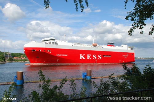
 Danube Highway
Current Status
Where is the vessel?
Danube Highway is currently in 27 nm W of Vikati Sadam, based on AIS data received less than 1h ago.
Latest AIS update:
Current position: 58.51125° N, 21.05947° E (27 nm W of Vikati Sadam)
Average speed (last 7 days): Loading…
Average speed (last 30 days): Loading…
Vessel profile: Danube Highway is a Vehicles Carrier with dimensions 148m x 148m.
This page combines live AIS, route history, probable destination signals, nearby traffic, and port activity for practical vessel monitoring.
The current position of vessel Danube Highway is 58.51125 lat / 21.05947 lng. Updated: 2026-05-12 19:52:37 UTCNearest reference points:
- 37 nm W of Vikati Sadam
- 20 nm W of Kalana
- 18 nm N of Ventspils
Currently sailing under the flag of Bahamas ![]()
Danube Highway built in 2006 year
Deadweight:
7788 tDetails:
Live Vessel Danube Highway Analytics (details, animations, etc.)
Recent AIS points (UTC):
2026-05-12 15:41:07 UTC · 57.50641, 19.70011 · SOG 17.9 kn · COG 36°2026-05-12 17:45:30 UTC · 57.98972, 20.40971 · SOG 17.9 kn · COG 33°
2026-05-12 19:43:56 UTC · 58.47590, 21.01458 · SOG 17.6 kn · COG 33°
2026-05-12 19:52:37 UTC · 58.51125, 21.05947 · SOG 17.6 kn · COG 33°