 vesseltracker.com
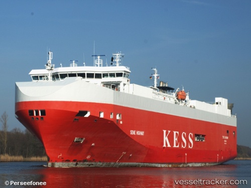
 Seine Highway
Current Status
Where is the vessel?
Seine Highway is currently in Near Emden, based on AIS data received less than 1h ago.
Latest AIS update:
Current position: 53.33907° N, 7.18189° E (Near Emden)
Average speed (last 7 days): Loading…
Average speed (last 30 days): Loading…
Vessel profile: Seine Highway is a Vehicles Carrier with dimensions 148m x 25m.
This page combines live AIS, route history, probable destination signals, nearby traffic, and port activity for practical vessel monitoring.
The current position of vessel Seine Highway is 53.33907 lat / 7.18189 lng. Updated: 2026-05-13 11:58:24 UTCNearest reference points:
- Near Emden
- Near APPINGEDAM
- Near NORDDEICH
Currently sailing under the flag of Bahamas ![]()
Seine Highway built in 2007 year
Deadweight:
8100 tDetails:
Live Vessel Seine Highway Analytics (details, animations, etc.)
Recent AIS points (UTC):
2026-05-13 05:43:23 UTC · 53.33908, 7.18189 · SOG 0 kn · COG 212°2026-05-13 09:46:50 UTC · 53.33908, 7.18189 · SOG 0 kn · COG -1°
2026-05-13 10:49:22 UTC · 53.33908, 7.18190 · SOG 0 kn · COG 242°
2026-05-13 11:58:24 UTC · 53.33907, 7.18189 · SOG 0 kn · COG 212°