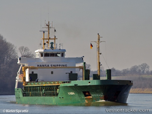
 KAISA
KAISA
Current Status
Where is the vessel?
KAISA is currently in Near Tetney Terminal, based on AIS data received about 14h ago.
Latest AIS update:
Current position: 53.56430° N, 0.09825° E (Near Tetney Terminal)
Average speed (last 7 days): Loading…
Average speed (last 30 days): Loading…
Vessel profile: KAISA is a General Cargo with dimensions m x m.
This page combines live AIS, route history, probable destination signals, nearby traffic, and port activity for practical vessel monitoring.
The current position of vessel KAISA is 53.56430 lat / 0.09825 lng. Updated: 2026-05-20 22:15:07 UTCNearest reference points:
- Near Grimsby
- Near Immingham
- Near Withernsea
Currently sailing under the flag of Antigua and Barbuda ![]()
Details:
Live Vessel KAISA Analytics (details, animations, etc.)
Recent AIS points (UTC):
2026-05-20 16:58:30 UTC · 53.69943, -0.39376 · SOG 0 kn · COG 182°2026-05-20 17:34:30 UTC · 53.69942, -0.39377 · SOG 0 kn · COG 182°
2026-05-20 22:08:26 UTC · 53.57426, 0.07236 · SOG 8 kn · COG 125°
2026-05-20 22:15:07 UTC · 53.56430, 0.09825 · SOG 12.8 kn · COG 125°