 vesseltracker.com
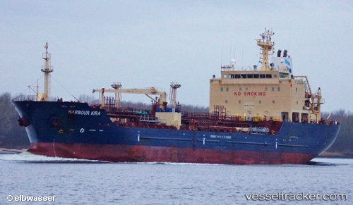
 Caribe Maria
Current Status
Where is the vessel?
Caribe Maria is currently in 17 nm NW of Oostende, based on AIS data received about 14h ago.
Latest AIS update:
Current position: 51.42610° N, 2.59208° E (17 nm NW of Oostende)
Average speed (last 7 days): Loading…
Average speed (last 30 days): Loading…
Vessel profile: Caribe Maria is a Chemical Oil Products Tanker with dimensions 116m x 20m.
This page combines live AIS, route history, probable destination signals, nearby traffic, and port activity for practical vessel monitoring.
The current position of vessel Caribe Maria is 51.42610 lat / 2.59208 lng. Updated: 2026-05-17 20:09:12 UTCNearest reference points:
- 13 nm NW of Middelkerke
- Near Lombardsijde
- Near Oostende
Currently sailing under the flag of Liberia ![]()
Caribe Maria built in 2007 year
Deadweight:
11299 tDetails:
Live Vessel Caribe Maria Analytics (details, animations, etc.)
Recent AIS points (UTC):
2026-05-17 16:18:11 UTC · 51.42771, 2.59617 · SOG 0 kn · COG 228°2026-05-17 18:06:11 UTC · 51.42786, 2.59575 · SOG 0 kn · COG 202°
2026-05-17 19:30:11 UTC · 51.42560, 2.59386 · SOG 0.5 kn · COG 332°
2026-05-17 20:09:12 UTC · 51.42610, 2.59208 · SOG 0 kn · COG 28°