 Rhourd El Hamra
Current Status
Where is the vessel?
Rhourd El Hamra is currently in Near Mostaganem, based on AIS data received about 15h ago.
Latest AIS update:
Current position: 35.95887° N, 0.06331° W (Near Mostaganem)
Average speed (last 7 days): Loading…
Average speed (last 30 days): Loading…
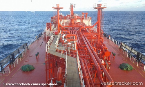
Vessel profile: Rhourd El Hamra is a Lpg Tanker with dimensions 156m x 25m.
This page combines live AIS, route history, probable destination signals, nearby traffic, and port activity for practical vessel monitoring.
The current position of vessel Rhourd El Hamra is 35.95887 lat / -0.06331 lng. Updated: 2026-05-21 22:23:31 UTCNearest reference points:
- Near Mostaganem
- Near Arzew
- Near Oran
Currently sailing under the flag of Algeria ![]()
Rhourd El Hamra built in 2008 year
Deadweight:
19277 tDetails:
Live Vessel Rhourd El Hamra Analytics (details, animations, etc.)
Recent AIS points (UTC):
2026-05-21 19:50:01 UTC · 35.96765, -0.03993 · SOG 0.7 kn · COG 109°2026-05-21 19:57:20 UTC · 35.96630, -0.04092 · SOG 0.8 kn · COG 118°
2026-05-21 22:07:31 UTC · 35.95635, -0.06005 · SOG 0.7 kn · COG 140°
2026-05-21 22:23:31 UTC · 35.95887, -0.06331 · SOG 0.9 kn · COG 141°