 vesseltracker.com
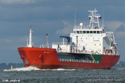
 Syn Tabit
Current Status
Where is the vessel?
Syn Tabit is currently in 41 nm W of Stintino, based on AIS data received less than 1h ago.
Latest AIS update:
Current position: 41.13836° N, 7.35673° E (41 nm W of Stintino)
Average speed (last 7 days): Loading…
Average speed (last 30 days): Loading…
Vessel profile: Syn Tabit is a Lpg Tanker with dimensions 96m x 95m.
This page combines live AIS, route history, probable destination signals, nearby traffic, and port activity for practical vessel monitoring.
The current position of vessel Syn Tabit is 41.13836 lat / 7.35673 lng. Updated: 2026-05-13 11:51:52 UTCNearest reference points:
- 42 nm NE of Mirabel
- Near Valledoria
- Near Ajaccio
Currently sailing under the flag of Italy ![]()
Syn Tabit built in 2007 year
Deadweight:
4026 tDetails:
Live Vessel Syn Tabit Analytics (details, animations, etc.)
Recent AIS points (UTC):
2026-05-13 05:41:12 UTC · 40.13770, 8.02706 · SOG 12.7 kn · COG 357°2026-05-13 09:46:54 UTC · 40.89186, 7.63643 · SOG 11.9 kn · COG 320°
2026-05-13 10:49:12 UTC · 41.03647, 7.47237 · SOG 9.7 kn · COG 320°
2026-05-13 11:51:52 UTC · 41.13836, 7.35673 · SOG 6.2 kn · COG 321°