 PINAR GAS
Current Status
Where is the vessel?
PINAR GAS is currently in 16 nm SE of Shinas, based on AIS data received about 14h ago.
Latest AIS update:
Current position: 24.54851° N, 56.68279° E (16 nm SE of Shinas)
Average speed (last 7 days): Loading…
Average speed (last 30 days): Loading…
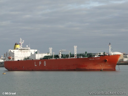
Vessel profile: PINAR GAS is a Lpg Tanker with dimensions m x m.
This page combines live AIS, route history, probable destination signals, nearby traffic, and port activity for practical vessel monitoring.
The current position of vessel PINAR GAS is 24.54851 lat / 56.68279 lng. Updated: 2026-07-04 14:10:58 UTCNearest reference points:
- 17 nm SE of Shinas
- 18 nm SE of SHINAS
- 42 nm SE of Offshore Fujairah
Currently sailing under the flag of Panama ![]()
Details:
Live Vessel PINAR GAS Analytics (details, animations, etc.)
Recent AIS points (UTC):
2026-07-04 10:05:01 UTC · 24.54679, 56.68200 · SOG 0 kn · COG 84°2026-07-04 11:23:01 UTC · 24.54716, 56.68198 · SOG 0 kn · COG 94°
2026-07-04 13:17:43 UTC · 24.54826, 56.68242 · SOG 0 kn · COG -1°
2026-07-04 14:10:58 UTC · 24.54851, 56.68279 · SOG 0 kn · COG 146°