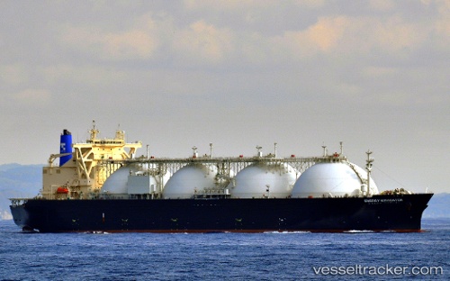
 Energy Navigator
Current Status
Where is the vessel?
Energy Navigator is currently in 83 nm S of Selat Lombok, based on AIS data received about 15h ago.
Latest AIS update:
Current position: 10.16500° S, 115.34333° E (83 nm S of Selat Lombok)
Average speed (last 7 days): Loading…
Average speed (last 30 days): Loading…
Vessel profile: Energy Navigator is a Lng Tanker with dimensions 289m x 49m.
This page combines live AIS, route history, probable destination signals, nearby traffic, and port activity for practical vessel monitoring.
The current position of vessel Energy Navigator is -10.16500 lat / 115.34333 lng. Updated: 2026-05-20 19:04:21 UTCNearest reference points:
- Near BENOA
- Near LEMBAR
- 86 nm SE of BENETE
Currently sailing under the flag of Japan ![]()
Details:
Live Vessel Energy Navigator Analytics (details, animations, etc.)
Recent AIS points (UTC):
2026-05-20 15:59:57 UTC · -10.15624, 114.89410 · SOG 9 kn · COG 90°2026-05-20 16:33:08 UTC · -10.15781, 114.97692 · SOG 8.7 kn · COG 92°
2026-05-20 17:34:23 UTC · -10.15833, 115.12667 · SOG 8 kn · COG -1°
2026-05-20 19:04:21 UTC · -10.16500, 115.34333 · SOG 8 kn · COG -1°