 vesseltracker.com
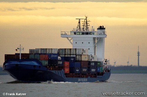
 Spica J
Current Status
Where is the vessel?
Spica J is currently in 27 nm W of Dale Roads, based on AIS data received less than 1h ago.
Latest AIS update:
Current position: 51.59772° N, 5.84725° W (27 nm W of Dale Roads)
Average speed (last 7 days): Loading…
Average speed (last 30 days): Loading…
Vessel profile: Spica J is a Container Ship with dimensions 140m x 22m.
This page combines live AIS, route history, probable destination signals, nearby traffic, and port activity for practical vessel monitoring.
The current position of vessel Spica J is 51.59772 lat / -5.84725 lng. Updated: 2026-05-15 16:35:26 UTCNearest reference points:
- Near WEXFORD
- 10 nm NW of Grampound
- Near ARKLOW
Currently sailing under the flag of Antigua Barbuda ![]()
Spica J built in 2007 year
Deadweight:
11186 tDetails:
Live Vessel Spica J Analytics (details, animations, etc.)
Recent AIS points (UTC):
2026-05-15 13:05:44 UTC · 50.79692, -5.86170 · SOG 13.2 kn · COG 358°2026-05-15 13:49:55 UTC · 50.95785, -5.87039 · SOG 13.5 kn · COG 349°
2026-05-15 15:58:46 UTC · 51.45062, -5.84255 · SOG 14.2 kn · COG 0°
2026-05-15 16:35:26 UTC · 51.59772, -5.84725 · SOG 14.7 kn · COG 358°