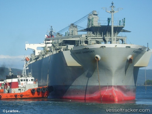
Forest Harmony
Current StatusWhere is the vessel?
Forest Harmony is currently in Near SAKAIMINATO, based on AIS data received about 15h ago.
Latest AIS update:
Current position: 35.54024° N, 133.25639° E (Near SAKAIMINATO)
Average speed (last 7 days): Loading…
Average speed (last 30 days): Loading…
Vessel profile: Forest Harmony is a Wood Chips Carrier with dimensions 32m x 192m.
This page combines live AIS, route history, probable destination signals, nearby traffic, and port activity for practical vessel monitoring.
The current position of vessel Forest Harmony is 35.54024 lat / 133.25639 lng. Updated: 2026-05-20 19:03:39 UTCNearest reference points:
- Near FUKUYAMA
- Near Kurashiki
- Near MIZUSHIMA
Details:
Live Vessel Forest Harmony Analytics (details, animations, etc.)
Recent AIS points (UTC):
2026-05-20 15:51:38 UTC · 35.54020, 133.25633 · SOG 0 kn · COG 236°2026-05-20 17:06:38 UTC · 35.54023, 133.25636 · SOG 0 kn · COG 236°
2026-05-20 18:18:41 UTC · 35.54022, 133.25639 · SOG 0 kn · COG 236°
2026-05-20 19:03:39 UTC · 35.54024, 133.25639 · SOG 0 kn · COG 236°