 vesseltracker.com
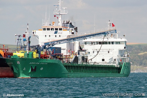
 NICOLA L
Current Status
Where is the vessel?
NICOLA L is currently in 16 nm E of Krieschow, based on AIS data received about 15h ago.
Latest AIS update:
Current position: 51.66284° N, 2.21536° E (16 nm E of Krieschow)
Average speed (last 7 days): Loading…
Average speed (last 30 days): Loading…
Vessel profile: NICOLA L is a General Cargo with dimensions m x m.
This page combines live AIS, route history, probable destination signals, nearby traffic, and port activity for practical vessel monitoring.
The current position of vessel NICOLA L is 51.66284 lat / 2.21536 lng. Updated: 2026-05-18 11:54:56 UTCNearest reference points:
- 13 nm NW of Middelkerke
- 15 nm E of RAMSGATE
- 11 nm NW of Krieschow
Currently sailing under the flag of Antigua and Barbuda ![]()
Details:
Live Vessel NICOLA L Analytics (details, animations, etc.)
Recent AIS points (UTC):
2026-05-18 07:50:31 UTC · 52.22467, 3.02766 · SOG 10.8 kn · COG 228°2026-05-18 09:46:46 UTC · 51.94743, 2.63820 · SOG 11.3 kn · COG 225°
2026-05-18 10:45:16 UTC · 51.80935, 2.43872 · SOG 11.2 kn · COG 225°
2026-05-18 11:54:56 UTC · 51.66284, 2.21536 · SOG 9.2 kn · COG 228°