 SEA BREEZE
Current Status
Where is the vessel?
SEA BREEZE is currently in Near Volos, based on AIS data received about 16h ago.
Latest AIS update:
Current position: 39.35598° N, 22.93953° E (Near Volos)
Average speed (last 7 days): Loading…
Average speed (last 30 days): Loading…
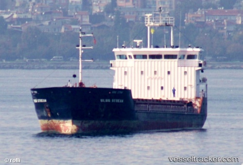
Vessel profile: SEA BREEZE is a General Cargo with dimensions m x m.
This page combines live AIS, route history, probable destination signals, nearby traffic, and port activity for practical vessel monitoring.
The current position of vessel SEA BREEZE is 39.35598 lat / 22.93953 lng. Updated: 2026-05-22 04:12:54 UTCNearest reference points:
- Near Volos
- Near Agriá
- Near Amaliápolis
Currently sailing under the flag of Guinea ![]()
Details:
Live Vessel SEA BREEZE Analytics (details, animations, etc.)
Recent AIS points (UTC):
2026-05-22 01:09:52 UTC · 39.35585, 22.93963 · SOG 0 kn · COG 61°2026-05-22 02:03:53 UTC · 39.35598, 22.93958 · SOG 0 kn · COG 61°
2026-05-22 03:30:53 UTC · 39.35600, 22.93953 · SOG 0 kn · COG 61°
2026-05-22 04:12:54 UTC · 39.35598, 22.93953 · SOG 0 kn · COG 61°