 GFS RHEA
Current Status
Where is the vessel?
GFS RHEA is currently in Near Pointe Noire, based on AIS data received about 14h ago.
Latest AIS update:
Current position: 4.77833° S, 11.82667° E (Near Pointe Noire)
Average speed (last 7 days): Loading…
Average speed (last 30 days): Loading…
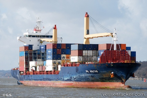
Vessel profile: GFS RHEA is a Container Ship with dimensions m x m.
This page combines live AIS, route history, probable destination signals, nearby traffic, and port activity for practical vessel monitoring.
The current position of vessel GFS RHEA is -4.77833 lat / 11.82667 lng. Updated: 2026-05-19 08:05:15 UTCNearest reference points:
- Near Pointe Noire
- Near N'Kossa Terminal
- Near Futila Terminal
Details:
Live Vessel GFS RHEA Analytics (details, animations, etc.)
Recent AIS points (UTC):
2026-05-19 04:12:22 UTC · -4.77854, 11.82811 · SOG 0 kn · COG 271°2026-05-19 06:03:18 UTC · -4.77848, 11.82799 · SOG 0 kn · COG 271°
2026-05-19 07:54:21 UTC · -4.77852, 11.82808 · SOG 0 kn · COG 272°
2026-05-19 08:05:15 UTC · -4.77833, 11.82667 · SOG 0 kn · COG -1°