 CELTIC EXPLORER
Current Status
Where is the vessel?
CELTIC EXPLORER is currently in Near TANGER MED, based on AIS data received about 15h ago.
Latest AIS update:
Current position: 35.89116° N, 5.50413° W (Near TANGER MED)
Average speed (last 7 days): Loading…
Average speed (last 30 days): Loading…
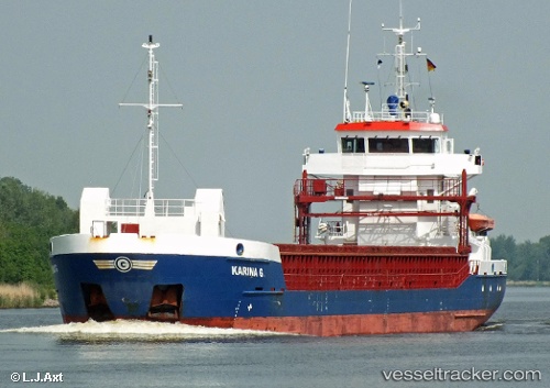
Vessel profile: CELTIC EXPLORER is a General Cargo Ship with dimensions 88m x 12m.
This page combines live AIS, route history, probable destination signals, nearby traffic, and port activity for practical vessel monitoring.
The current position of vessel CELTIC EXPLORER is 35.89116 lat / -5.50413 lng. Updated: 2026-05-20 17:32:19 UTCNearest reference points:
- Near TARIFA
- Near TANGER MED
- Near Algeciras
Currently sailing under the flag of Antigua and Barbuda ![]()
CELTIC EXPLORER built in 2007 year
Deadweight:
3875 tDetails:
Live Vessel CELTIC EXPLORER Analytics (details, animations, etc.)
Recent AIS points (UTC):
2026-05-20 13:38:19 UTC · 35.89116, -5.50414 · SOG 0 kn · COG 40°2026-05-20 16:05:20 UTC · 35.89122, -5.50420 · SOG 0 kn · COG 39°
2026-05-20 16:50:17 UTC · 35.89115, -5.50418 · SOG 0 kn · COG 40°
2026-05-20 17:32:19 UTC · 35.89116, -5.50413 · SOG 0 kn · COG 40°