 MARTI STAR II
Current Status
Where is the vessel?
MARTI STAR II is currently in 107 nm SE of Lü-hua Shan, based on AIS data received about 14h ago.
Latest AIS update:
Current position: 29.87167° N, 124.35833° E (107 nm SE of Lü-hua Shan)
Average speed (last 7 days): Loading…
Average speed (last 30 days): Loading…
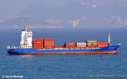
Vessel profile: MARTI STAR II is a Container Ship with dimensions m x m.
This page combines live AIS, route history, probable destination signals, nearby traffic, and port activity for practical vessel monitoring.
The current position of vessel MARTI STAR II is 29.87167 lat / 124.35833 lng. Updated: 2026-06-26 07:07:28 UTCNearest reference points:
- 75 nm SE of Lü-hua Shan
- 74 nm SE of Lü-hua Shan
- 77 nm SE of Lü-hua Shan
Currently sailing under the flag of Liberia ![]()
Details:
Live Vessel MARTI STAR II Analytics (details, animations, etc.)
Recent AIS points (UTC):
2026-06-26 04:12:33 UTC · 29.72583, 123.56196 · SOG 14.7 kn · COG 77°2026-06-26 04:59:21 UTC · 29.76346, 123.77656 · SOG 14.6 kn · COG 77°
2026-06-26 05:29:04 UTC · 29.78852, 123.91230 · SOG 14.6 kn · COG 75°
2026-06-26 07:07:28 UTC · 29.87167, 124.35833 · SOG 14 kn · COG -1°