 RIYADH MUKAAB
Current Status
Where is the vessel?
RIYADH MUKAAB is currently in Near Wu-Sung, based on AIS data received about 14h ago.
Latest AIS update:
Current position: 31.41747° N, 121.51438° E (Near Wu-Sung)
Average speed (last 7 days): Loading…
Average speed (last 30 days): Loading…
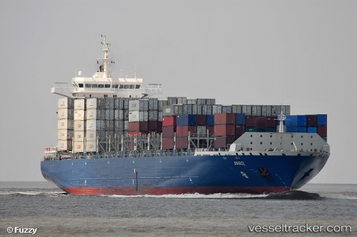
Vessel profile: RIYADH MUKAAB is a Container Ship with dimensions m x m.
This page combines live AIS, route history, probable destination signals, nearby traffic, and port activity for practical vessel monitoring.
The current position of vessel RIYADH MUKAAB is 31.41747 lat / 121.51438 lng. Updated: 2026-05-20 10:11:51 UTCNearest reference points:
- Near Baoshan Pt
- Near Wu-Sung
- Near Jinqiao
Currently sailing under the flag of Liberia ![]()
Details:
Live Vessel RIYADH MUKAAB Analytics (details, animations, etc.)
Recent AIS points (UTC):
2026-05-20 07:47:55 UTC · 31.64838, 121.21657 · SOG 0 kn · COG 309°2026-05-20 07:47:55 UTC · 31.64838, 121.21657 · SOG 0 kn · COG 309°
2026-05-20 10:05:15 UTC · 31.42800, 121.49542 · SOG 9 kn · COG 134°
2026-05-20 10:11:51 UTC · 31.41747, 121.51438 · SOG 11.8 kn · COG 120°