 Empire State
Current Status
Where is the vessel?
Empire State is currently in Near Anacortes, based on AIS data received about 14h ago.
Latest AIS update:
Current position: 48.51938° N, 122.58559° W (Near Anacortes)
Average speed (last 7 days): Loading…
Average speed (last 30 days): Loading…
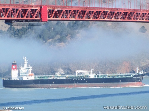
Vessel profile: Empire State is a Chemical Oil Products Tanker with dimensions 183m x 32m.
This page combines live AIS, route history, probable destination signals, nearby traffic, and port activity for practical vessel monitoring.
The current position of vessel Empire State is 48.51938 lat / -122.58559 lng. Updated: 2026-07-25 10:10:29 UTCNearest reference points:
- Near Anacortes
- Near Bellingham
- Near ORCAS
Currently sailing under the flag of USA ![]()
Details:
Live Vessel Empire State Analytics (details, animations, etc.)
Recent AIS points (UTC):
2026-07-25 07:14:18 UTC · 48.51918, -122.58455 · SOG 0.5 kn · COG 117°2026-07-25 07:46:34 UTC · 48.51990, -122.58467 · SOG 0.2 kn · COG 144°
2026-07-25 09:22:34 UTC · 48.52007, -122.58490 · SOG 0.1 kn · COG 140°
2026-07-25 10:10:29 UTC · 48.51938, -122.58559 · SOG 0.1 kn · COG 117°