 vesseltracker.com
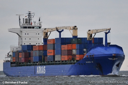
 WANDA A
Current Status
Where is the vessel?
WANDA A is currently in Near INEBOLU, based on AIS data received less than 1h ago.
Latest AIS update:
Current position: 42.08050° N, 33.61890° E (Near INEBOLU)
Average speed (last 7 days): Loading…
Average speed (last 30 days): Loading…
Vessel profile: WANDA A is a Container Ship with dimensions 184m x 184m.
This page combines live AIS, route history, probable destination signals, nearby traffic, and port activity for practical vessel monitoring.
The current position of vessel WANDA A is 42.08050 lat / 33.61890 lng. Updated: 2026-05-13 11:17:58 UTCNearest reference points:
- 18 nm NW of INEBOLU
- 27 nm NW of INEBOLU
- Near Cide
Currently sailing under the flag of Malta ![]()
WANDA A built in 2009 year
Deadweight:
21990 tDetails:
Live Vessel WANDA A Analytics (details, animations, etc.)
Recent AIS points (UTC):
2026-05-13 02:40:25 UTC · 42.15919, 35.86323 · SOG 11.5 kn · COG 272°2026-05-13 09:47:38 UTC · 42.11939, 34.00899 · SOG 11.6 kn · COG 266°
2026-05-13 11:07:27 UTC · 42.08515, 33.66397 · SOG 11.6 kn · COG 262°
2026-05-13 11:17:58 UTC · 42.08050, 33.61890 · SOG 11.2 kn · COG 262°