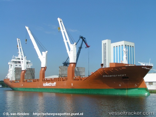
 Dynamogracht
Current Status
Where is the vessel?
Dynamogracht is currently in 24 nm S of Chittagong, based on AIS data received about 14h ago.
Latest AIS update:
Current position: 21.94500° N, 91.66333° E (24 nm S of Chittagong)
Average speed (last 7 days): Loading…
Average speed (last 30 days): Loading…
Vessel profile: Dynamogracht is a General Cargo Ship with dimensions 157m x 23m.
This page combines live AIS, route history, probable destination signals, nearby traffic, and port activity for practical vessel monitoring.
The current position of vessel Dynamogracht is 21.94500 lat / 91.66333 lng. Updated: 2026-05-20 23:08:50 UTCNearest reference points:
- 23 nm NW of Cox's Bazar
- Near Chittagong
- 12 nm NW of Chattogram
Currently sailing under the flag of Netherlands ![]()
Dynamogracht built in 2010 year
Deadweight:
17967 tDetails:
Live Vessel Dynamogracht Analytics (details, animations, etc.)
Recent AIS points (UTC):
2026-05-20 19:29:05 UTC · 22.24436, 91.73327 · SOG 0.4 kn · COG 168°2026-05-20 22:20:28 UTC · 22.13624, 91.72449 · SOG 14 kn · COG 198°
2026-05-20 22:43:46 UTC · 22.04737, 91.69577 · SOG 14.7 kn · COG 197°
2026-05-20 23:08:50 UTC · 21.94500, 91.66333 · SOG 15 kn · COG -1°