 vesseltracker.com
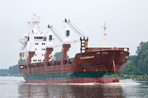
 Florijngracht
Current Status
Where is the vessel?
Florijngracht is currently in 27 nm NW of Bridport, based on AIS data received less than 1h ago.
Latest AIS update:
Current position: 40.62851° S, 147.07756° E (27 nm NW of Bridport)
Average speed (last 7 days): Loading…
Average speed (last 30 days): Loading…
Vessel profile: Florijngracht is a General Cargo Ship with dimensions 137m x 137m.
This page combines live AIS, route history, probable destination signals, nearby traffic, and port activity for practical vessel monitoring.
The current position of vessel Florijngracht is -40.62851 lat / 147.07756 lng. Updated: 2026-05-14 23:38:44 UTCNearest reference points:
- Near Beaconsfield
- Near LINDISFARNE
- Near Hobart
Currently sailing under the flag of Netherlands ![]()
Florijngracht built in 2010 year
Deadweight:
12500 tDetails:
Live Vessel Florijngracht Analytics (details, animations, etc.)
Recent AIS points (UTC):
2026-05-14 20:26:04 UTC · -40.56974, 147.80701 · SOG 10.2 kn · COG 291°2026-05-14 21:46:54 UTC · -40.57358, 147.50513 · SOG 10.7 kn · COG 260°
2026-05-14 22:18:45 UTC · -40.58985, 147.38280 · SOG 10.6 kn · COG 263°
2026-05-14 23:38:44 UTC · -40.62851, 147.07756 · SOG 10.5 kn · COG 262°