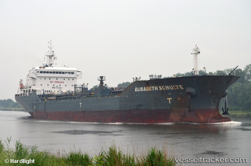
 ELISABETH SCHULTE
Current Status
Where is the vessel?
ELISABETH SCHULTE is currently in 14 nm SE of Ystad, based on AIS data received about 14h ago.
Latest AIS update:
Current position: 55.21832° N, 14.05484° E (14 nm SE of Ystad)
Average speed (last 7 days): Loading…
Average speed (last 30 days): Loading…
Vessel profile: ELISABETH SCHULTE is a Oil/Chemical Tanker with dimensions m x m.
This page combines live AIS, route history, probable destination signals, nearby traffic, and port activity for practical vessel monitoring.
The current position of vessel ELISABETH SCHULTE is 55.21832 lat / 14.05484 lng. Updated: 2026-07-01 22:23:07 UTCNearest reference points:
- Near Åhus
- Near TEJN
- Near SASSNITZ
Currently sailing under the flag of Marshall Islands ![]()
Details:
Live Vessel ELISABETH SCHULTE Analytics (details, animations, etc.)
Recent AIS points (UTC):
2026-07-01 19:44:47 UTC · 55.45530, 14.63004 · SOG 9.6 kn · COG 244°2026-07-01 20:00:46 UTC · 55.42656, 14.57359 · SOG 10 kn · COG 220°
2026-07-01 21:45:56 UTC · 55.21493, 14.22927 · SOG 9.6 kn · COG 272°
2026-07-01 22:23:07 UTC · 55.21832, 14.05484 · SOG 9.4 kn · COG 272°