 vesseltracker.com
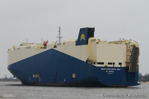
 Mediterranean Sea
Current Status
Where is the vessel?
Mediterranean Sea is currently in 387 nm SW of Antofagasta, based on AIS data received about 14h ago.
Latest AIS update:
Current position: 28.00209° S, 65.14098° E (387 nm SW of Antofagasta)
Average speed (last 7 days): Loading…
Average speed (last 30 days): Loading…
Vessel profile: Mediterranean Sea is a Vehicles Carrier with dimensions 183m x 32m.
This page combines live AIS, route history, probable destination signals, nearby traffic, and port activity for practical vessel monitoring.
The current position of vessel Mediterranean Sea is -28.00209 lat / 65.14098 lng. Updated: 2026-05-17 22:18:23 UTCNearest reference points:
- Open sea, approx. 403 nm off the nearest listed port
- Open sea, approx. 400 nm off the nearest listed port
- Open sea, approx. 409 nm off the nearest listed port
Currently sailing under the flag of Marshall Is ![]()
Mediterranean Sea built in 2010 year
Deadweight:
14774 tDetails:
Live Vessel Mediterranean Sea Analytics (details, animations, etc.)
Recent AIS points (UTC):
2026-05-17 19:20:15 UTC · -27.76507, 65.89058 · SOG 13.8 kn · COG 251°2026-05-17 19:33:14 UTC · -27.78130, 65.83484 · SOG 14.6 kn · COG 250°
2026-05-17 21:24:45 UTC · -27.93016, 65.36496 · SOG 13.8 kn · COG 247°
2026-05-17 22:18:23 UTC · -28.00209, 65.14098 · SOG 14.3 kn · COG 247°