 vesseltracker.com
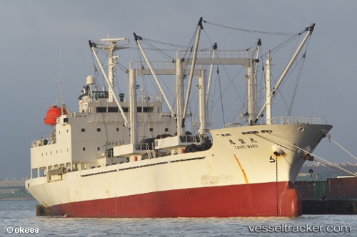
 TAIHO MARU
Current Status
Where is the vessel?
TAIHO MARU is currently in Near Gamcheon/Busan, based on AIS data received about 15h ago.
Latest AIS update:
Current position: 35.06557° N, 129.01030° E (Near Gamcheon/Busan)
Average speed (last 7 days): Loading…
Average speed (last 30 days): Loading…
Vessel profile: TAIHO MARU is a Refrigerated Cargo Ship with dimensions 17m x 98m.
This page combines live AIS, route history, probable destination signals, nearby traffic, and port activity for practical vessel monitoring.
The current position of vessel TAIHO MARU is 35.06557 lat / 129.01030 lng. Updated: 2026-05-17 21:30:12 UTCNearest reference points:
- Near Gamcheon/Busan
- Near Busan
- Near BUSAN NEW PORT
Currently sailing under the flag of Panama ![]()
TAIHO MARU built in 2008 year
Deadweight:
4393 tDetails:
Live Vessel TAIHO MARU Analytics (details, animations, etc.)
Recent AIS points (UTC):
2026-05-17 18:00:11 UTC · 35.06553, 129.01027 · SOG 0 kn · COG 292°2026-05-17 20:00:13 UTC · 35.06555, 129.01030 · SOG 0 kn · COG 292°
2026-05-17 20:15:13 UTC · 35.06555, 129.01030 · SOG 0 kn · COG 292°
2026-05-17 21:30:12 UTC · 35.06557, 129.01030 · SOG 0 kn · COG 292°