 Global Harmony
Current Status
Where is the vessel?
Global Harmony is currently in Near Batumi, based on AIS data received about 16h ago.
Latest AIS update:
Current position: 41.68850° N, 41.67667° E (Near Batumi)
Average speed (last 7 days): Loading…
Average speed (last 30 days): Loading…
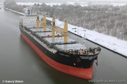
Vessel profile: Global Harmony is a Bulk Carrier with dimensions 180m x 30m.
This page combines live AIS, route history, probable destination signals, nearby traffic, and port activity for practical vessel monitoring.
The current position of vessel Global Harmony is 41.68850 lat / 41.67667 lng. Updated: 2026-05-22 19:28:03 UTCNearest reference points:
- Near Batumi
- Near Sup'sa
- Near Poti
Currently sailing under the flag of Liberia ![]()
Global Harmony built in 2010 year
Deadweight:
35000 tDetails:
Live Vessel Global Harmony Analytics (details, animations, etc.)
Recent AIS points (UTC):
2026-05-22 17:03:38 UTC · 41.68888, 41.67616 · SOG 0 kn · COG 207°2026-05-22 18:21:41 UTC · 41.68883, 41.67625 · SOG 0 kn · COG 213°
2026-05-22 19:03:36 UTC · 41.68864, 41.67655 · SOG 0 kn · COG 218°
2026-05-22 19:28:03 UTC · 41.68850, 41.67667 · SOG 0 kn · COG 221°