 vesseltracker.com
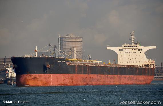
 ANTELAO
Current Status
Where is the vessel?
ANTELAO is currently in 297 nm W of Calang, based on AIS data received less than 1h ago.
Latest AIS update:
Current position: 3.06847° N, 90.87193° E (297 nm W of Calang)
Average speed (last 7 days): Loading…
Average speed (last 30 days): Loading…
Vessel profile: ANTELAO is a Cargo with dimensions m x m.
This page combines live AIS, route history, probable destination signals, nearby traffic, and port activity for practical vessel monitoring.
The current position of vessel ANTELAO is 3.06847 lat / 90.87193 lng. Updated: 2026-04-08 09:37:59 UTCNearest reference points:
- Open sea, approx. 414 nm off the nearest listed port
- Open sea, approx. 409 nm off the nearest listed port
- Open sea, approx. 402 nm off the nearest listed port
Currently sailing under the flag of Liberia ![]()
Details:
Live Vessel ANTELAO Analytics (details, animations, etc.)
Recent AIS points (UTC):
2026-04-08 04:16:50 UTC · 2.43662, 90.04872 · SOG 11.6 kn · COG -1°2026-04-08 05:42:01 UTC · 2.60139, 90.26449 · SOG 11.3 kn · COG -1°
2026-04-08 07:30:45 UTC · 2.82192, 90.54612 · SOG 12 kn · COG -1°
2026-04-08 09:37:59 UTC · 3.06847, 90.87193 · SOG 11.5 kn · COG 54°