 MDS ARTEMIS
Current Status
Where is the vessel?
MDS ARTEMIS is currently in Near Panama, based on AIS data received about 14h ago.
Latest AIS update:
Current position: 8.89311° N, 79.47420° W (Near Panama)
Average speed (last 7 days): Loading…
Average speed (last 30 days): Loading…
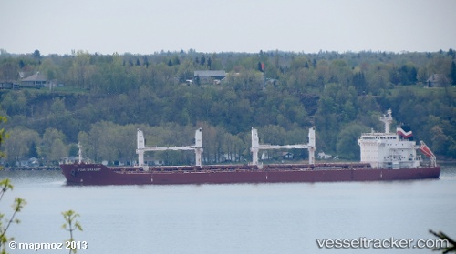
Vessel profile: MDS ARTEMIS is a Bulk Carrier with dimensions m x m.
This page combines live AIS, route history, probable destination signals, nearby traffic, and port activity for practical vessel monitoring.
The current position of vessel MDS ARTEMIS is 8.89311 lat / -79.47420 lng. Updated: 2026-05-20 00:26:35 UTCNearest reference points:
- Near Panama
- Near El Chorrillo
- Near Cocoli
Currently sailing under the flag of Marshall Islands ![]()
Details:
Live Vessel MDS ARTEMIS Analytics (details, animations, etc.)
Recent AIS points (UTC):
2026-05-19 20:23:28 UTC · 8.89643, -79.47408 · SOG 0.1 kn · COG 212°2026-05-19 22:08:28 UTC · 8.89432, -79.47305 · SOG 0.1 kn · COG 298°
2026-05-19 23:02:33 UTC · 8.89350, -79.47342 · SOG 0.1 kn · COG 322°
2026-05-20 00:26:35 UTC · 8.89311, -79.47420 · SOG 0.1 kn · COG 345°