 vesseltracker.com
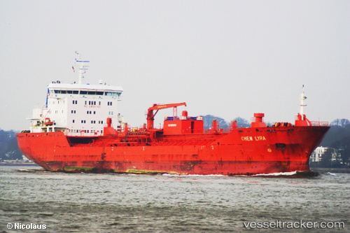
 Chem Lyra
Current Status
Where is the vessel?
Chem Lyra is currently in Near BUKOM ISLAND, based on AIS data received less than 1h ago.
Latest AIS update:
Current position: 1.18152° N, 103.70472° E (Near BUKOM ISLAND)
Average speed (last 7 days): Loading…
Average speed (last 30 days): Loading…
Vessel profile: Chem Lyra is a Chemical Oil Products Tanker with dimensions 144m x 144m.
This page combines live AIS, route history, probable destination signals, nearby traffic, and port activity for practical vessel monitoring.
The current position of vessel Chem Lyra is 1.18152 lat / 103.70472 lng. Updated: 2026-05-15 08:21:31 UTCNearest reference points:
- Near BUKOM ISLAND
- Near JURONG ISLAND
- Near Pulau Ayer Chawan
Currently sailing under the flag of Liberia ![]()
Chem Lyra built in 2009 year
Deadweight:
17055 tDetails:
Live Vessel Chem Lyra Analytics (details, animations, etc.)
Recent AIS points (UTC):
2026-05-15 04:30:33 UTC · 1.18050, 103.70578 · SOG 0.1 kn · COG 256°2026-05-15 06:12:34 UTC · 1.18106, 103.70554 · SOG 0 kn · COG 233°
2026-05-15 08:03:31 UTC · 1.18142, 103.70511 · SOG 0.1 kn · COG 213°
2026-05-15 08:21:31 UTC · 1.18152, 103.70472 · SOG 0.1 kn · COG 198°