 vesseltracker.com
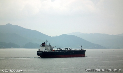
 SAFEEN ELONA
Current Status
Where is the vessel?
SAFEEN ELONA is currently in 31 nm E of MANGALIA, based on AIS data received about 1d ago.
Latest AIS update:
Current position: 43.71107° N, 29.29844° E (31 nm E of MANGALIA)
Average speed (last 7 days): Loading…
Average speed (last 30 days): Loading…
Vessel profile: SAFEEN ELONA is a Crude Oil Tanker with dimensions 244m x 42m.
This page combines live AIS, route history, probable destination signals, nearby traffic, and port activity for practical vessel monitoring.
The current position of vessel SAFEEN ELONA is 43.71107 lat / 29.29844 lng. Updated: 2026-05-12 16:21:34 UTCNearest reference points:
- 20 nm E of Eforie Sud
- Near Shabla
- Near Constanta
Currently sailing under the flag of Marshall Islands ![]()
SAFEEN ELONA built in 2012 year
Deadweight:
105258 tDetails:
Live Vessel SAFEEN ELONA Analytics (details, animations, etc.)
Recent AIS points (UTC):
2026-05-12 16:21:34 UTC · 43.71107, 29.29844 · SOG 11.1 kn · COG 102°2026-05-12 16:21:34 UTC · 43.71107, 29.29844 · SOG 11.1 kn · COG 102°
2026-05-12 16:21:34 UTC · 43.71107, 29.29844 · SOG 11.1 kn · COG 102°
2026-05-12 16:21:34 UTC · 43.71107, 29.29844 · SOG 11.1 kn · COG 102°