 vesseltracker.com
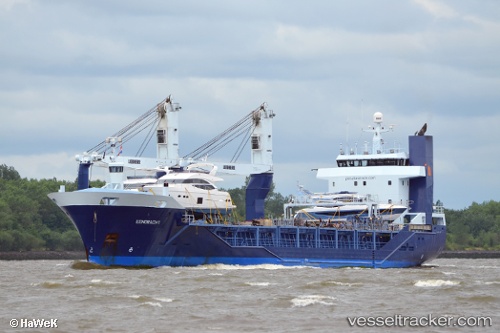
Eendracht
Current StatusWhere is the vessel?
Eendracht is currently in 14 nm S of Villafranca Tirrena, based on AIS data received less than 1h ago.
Latest AIS update:
Current position: 36.00245° N, 15.38202° E (14 nm S of Villafranca Tirrena)
Average speed (last 7 days): Loading…
Average speed (last 30 days): Loading…
Vessel profile: Eendracht is a General Cargo Ship with dimensions 16m x 105m.
This page combines live AIS, route history, probable destination signals, nearby traffic, and port activity for practical vessel monitoring.
The current position of vessel Eendracht is 36.00245 lat / 15.38202 lng. Updated: 2026-05-15 17:52:25 UTCNearest reference points:
- 18 nm E of Il-Kappara
- 13 nm E of Il-Kappara
- Near PORTOPALO
Details:
Live Vessel Eendracht Analytics (details, animations, etc.)
Recent AIS points (UTC):
2026-05-15 08:39:49 UTC · 35.06718, 18.15186 · SOG 16.3 kn · COG 292°2026-05-15 08:39:49 UTC · 35.06718, 18.15186 · SOG 16.3 kn · COG 292°
2026-05-15 08:39:49 UTC · 35.06718, 18.15186 · SOG 16.3 kn · COG 292°
2026-05-15 17:52:25 UTC · 36.00245, 15.38202 · SOG 15.7 kn · COG 292°