 vesseltracker.com
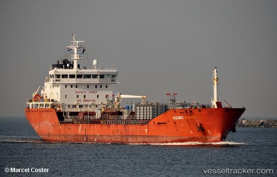
 ASTER ALVAR
Current Status
Where is the vessel?
ASTER ALVAR is currently in Near Llanwrda, based on AIS data received about 1h ago.
Latest AIS update:
Current position: 51.92162° N, 3.74284° E (Near Llanwrda)
Average speed (last 7 days): Loading…
Average speed (last 30 days): Loading…
Vessel profile: ASTER ALVAR is a Chemical/Oil Products Tanker with dimensions 130m x 19m.
This page combines live AIS, route history, probable destination signals, nearby traffic, and port activity for practical vessel monitoring.
The current position of vessel ASTER ALVAR is 51.92162 lat / 3.74284 lng. Updated: 2026-05-14 17:24:07 UTCNearest reference points:
- Near DEN OSSE
- 12 nm NE of Hunsdon
- Near Haarlemmermeer
Currently sailing under the flag of Portugal (MAR) ![]()
ASTER ALVAR built in 2011 year
Deadweight:
11596 tDetails:
Live Vessel ASTER ALVAR Analytics (details, animations, etc.)
Recent AIS points (UTC):
2026-05-14 14:09:12 UTC · 51.93229, 3.73682 · SOG 7.5 kn · COG 137°2026-05-14 16:03:11 UTC · 51.92152, 3.74331 · SOG 0.1 kn · COG 21°
2026-05-14 16:15:11 UTC · 51.92146, 3.74352 · SOG 0.2 kn · COG 9°
2026-05-14 17:24:07 UTC · 51.92162, 3.74284 · SOG 0 kn · COG 21°