 LM DEMETER
Current Status
Where is the vessel?
LM DEMETER is currently in Near Gávrion, based on AIS data received about 15h ago.
Latest AIS update:
Current position: 37.91673° N, 24.57065° E (Near Gávrion)
Average speed (last 7 days): Loading…
Average speed (last 30 days): Loading…
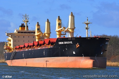
Vessel profile: LM DEMETER is a Bulk Carrier with dimensions m x m.
This page combines live AIS, route history, probable destination signals, nearby traffic, and port activity for practical vessel monitoring.
The current position of vessel LM DEMETER is 37.91673 lat / 24.57065 lng. Updated: 2026-05-20 22:03:06 UTCNearest reference points:
- Near Kéa (Tzia)
- Near Agia Marina Grammatikou Attikis
- Near LAVRIO
Currently sailing under the flag of Liberia ![]()
Details:
Live Vessel LM DEMETER Analytics (details, animations, etc.)
Recent AIS points (UTC):
2026-05-20 18:03:27 UTC · 38.42236, 24.89427 · SOG 6.7 kn · COG 210°2026-05-20 19:32:17 UTC · 38.27036, 24.79704 · SOG 7.6 kn · COG 208°
2026-05-20 21:51:26 UTC · 37.93739, 24.58671 · SOG 8.3 kn · COG 211°
2026-05-20 22:03:06 UTC · 37.91673, 24.57065 · SOG 6.9 kn · COG 212°