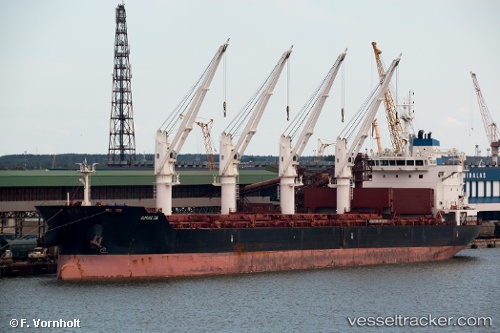
 Amalia
Current Status
Where is the vessel?
Amalia is currently in Open sea (no nearby ports in database), based on AIS data received about 14h ago.
Latest AIS update:
Current position: 40.28000° N, 158.76000° W (Open sea (no nearby ports in database))
Average speed (last 7 days): Loading…
Average speed (last 30 days): Loading…
Vessel profile: Amalia is a Bulk Carrier with dimensions 180m x 32m.
This page combines live AIS, route history, probable destination signals, nearby traffic, and port activity for practical vessel monitoring.
The current position of vessel Amalia is 40.28 lat / -158.76 lng. Updated: 2026-05-22 07:28:27 UTCNearest reference points:
- Open sea (no nearby ports in database)
Currently sailing under the flag of Malta ![]()
Amalia built in 2011 year
Deadweight:
34023 tDetails:
Live Vessel Amalia Analytics (details, animations, etc.)
Recent AIS points (UTC):
2026-05-22 04:00:19 UTC · 40.55720, -158.02300 · SOG 10.7 kn · COG 242°2026-05-22 06:13:17 UTC · 40.37390, -158.50000 · SOG 11.1 kn · COG 244°
2026-05-22 07:03:41 UTC · 40.31120, -158.67700 · SOG 10.4 kn · COG 239°
2026-05-22 07:28:27 UTC · 40.28000, -158.76000 · SOG 10.3 kn · COG 240°