 Lmz Europa
Current Status
Where is the vessel?
Lmz Europa is currently in Near Den Burg, based on AIS data received about 14h ago.
Latest AIS update:
Current position: 53.15295° N, 4.95867° W (Near Den Burg)
Average speed (last 7 days): Loading…
Average speed (last 30 days): Loading…
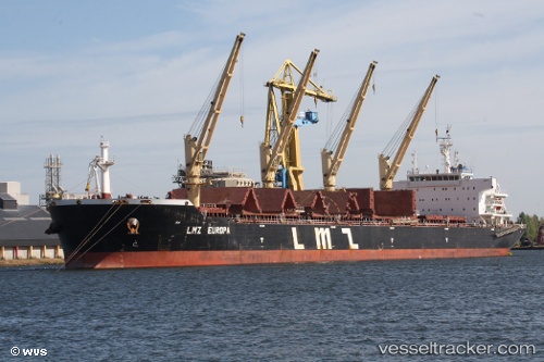
Vessel profile: Lmz Europa is a Bulk Carrier with dimensions 190m x 32m.
This page combines live AIS, route history, probable destination signals, nearby traffic, and port activity for practical vessel monitoring.
The current position of vessel Lmz Europa is 53.15295 lat / -4.95867 lng. Updated: 2026-05-25 23:47:46 UTCNearest reference points:
- Near Holyhead
- Near WICKLOW
- Near ARKLOW
Currently sailing under the flag of Marshall Is ![]()
Lmz Europa built in 2011 year
Deadweight:
56771 tDetails:
Live Vessel Lmz Europa Analytics (details, animations, etc.)
Recent AIS points (UTC):
2026-05-25 20:23:20 UTC · 52.60333, -5.28167 · SOG 10 kn · COG -1°2026-05-25 22:26:25 UTC · 52.93680, -5.08143 · SOG 10 kn · COG 15°
2026-05-25 22:49:15 UTC · 52.99695, -5.04695 · SOG 9.9 kn · COG 16°
2026-05-25 23:47:46 UTC · 53.15295, -4.95867 · SOG 10.2 kn · COG 18°