 vesseltracker.com
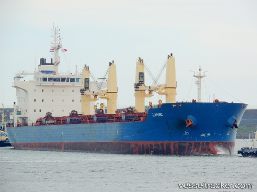
 LAMBI
LAMBI
Current Status
Where is the vessel?
LAMBI is currently in Near Jorf Lasfar, based on AIS data received less than 1h ago.
Latest AIS update:
Current position: 33.13260° N, 8.75424° W (Near Jorf Lasfar)
Average speed (last 7 days): Loading…
Average speed (last 30 days): Loading…
Vessel profile: LAMBI is a Bulk Carrier with dimensions 179m x 179m.
This page combines live AIS, route history, probable destination signals, nearby traffic, and port activity for practical vessel monitoring.
The current position of vessel LAMBI is 33.13260 lat / -8.75424 lng. Updated: 2026-04-08 14:09:52 UTCNearest reference points:
- Near Jorf Lasfar
- 21 nm NW of El Jadida
- 44 nm NW of El Jadida
Currently sailing under the flag of Marshall Islands ![]()
LAMBI built in 2012 year
Deadweight:
35048 tDetails:
Live Vessel LAMBI Analytics (details, animations, etc.)
Recent AIS points (UTC):
2026-04-08 08:18:43 UTC · 33.13210, -8.75468 · SOG 0.3 kn · COG 317°2026-04-08 10:04:30 UTC · 33.13255, -8.75446 · SOG 0.1 kn · COG -1°
2026-04-08 11:42:43 UTC · 33.13220, -8.75464 · SOG 0.5 kn · COG 312°
2026-04-08 14:09:52 UTC · 33.13260, -8.75424 · SOG 0.2 kn · COG -1°