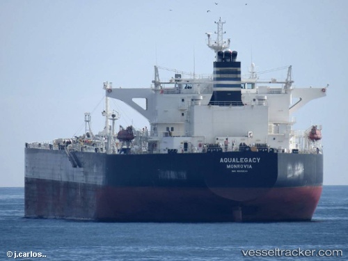
Aqualegacy
Current StatusWhere is the vessel?
Aqualegacy is currently in 35 nm SE of Daikoku Island, based on AIS data received about 14h ago.
Latest AIS update:
Current position: 42.49711° N, 145.37206° E (35 nm SE of Daikoku Island)
Average speed (last 7 days): Loading…
Average speed (last 30 days): Loading…
Vessel profile: Aqualegacy is a Crude Oil Tanker with dimensions 44m x 249m.
This page combines live AIS, route history, probable destination signals, nearby traffic, and port activity for practical vessel monitoring.
The current position of vessel Aqualegacy is 42.49711 lat / 145.37206 lng. Updated: 2026-05-20 13:03:07 UTCNearest reference points:
- 27 nm SE of Tomari
- Near Kushiro
- Near NISHI
Details:
Live Vessel Aqualegacy Analytics (details, animations, etc.)
Recent AIS points (UTC):
2026-05-20 09:32:14 UTC · 42.88323, 146.31319 · SOG 13.2 kn · COG 240°2026-05-20 10:47:14 UTC · 42.74874, 145.98956 · SOG 13.2 kn · COG 242°
2026-05-20 11:56:52 UTC · 42.62208, 145.67747 · SOG 14.1 kn · COG 242°
2026-05-20 13:03:07 UTC · 42.49711, 145.37206 · SOG 14.3 kn · COG 243°